Monday, November 23, 2015

Kindoroko Forest Part V

The peak with the clouds rolling over us. It eventually cleared.
For the first time we brought some friends up to Kindoroko Forest (Part I,Part II,Part III, Part IV). Our friends live in Chome in the South Pares (trip here) and although they've extensively explored the South Pares, they hadn't yet been to the north. We thought it would be fun to show them the parts we know and that means we start with Kindoroko!

Apparently they've recently had some rains during the "short rain" season, which this year is amplified due to El Nino in the Pacific Ocean. Being from America I am familiar with El Nino but I had no clue that it would affect somewhere as far as East Africa. The Pares are already pretty damp, so we prepared for the worst with full rain gear.

We arrived on Friday and spent the night so we could have an early start. We had leisurely breakfast and made our way to the trailhead by 10. The lower levels of the forest have really taken a beating from illegal timber gathering and grazing. Its noticeably thinner for the first half hour or so and for the first time we ran into some locals grazing their goats and cows. It was an incredibly steep and thick area for them to be in!

As we ascended deeper into the forest the buzz of the village died and the forest thickened. The branches and undergrowth were covered in moss and lichen and the ground soft from plenty of rain. As we got towards the top the clouds rolled from the west and drifted past us. The trail was thick and overgrown and there were places where (even armed with two machetes) we had to literally crawl through thorny lianas and branches.

When we reached the top we couldn't see anything but standing and watching the clouds roll by was ethereal. A falcon flying through the clouds added to the vibe and the sound of wind hitting the mountain ridge creates a peaceful and meditative feel. The clouds were moving quickly and you could catch glimpses of space between offering a sliver of a view. We had lunch at the peak and after about a half hour the clouds cleared and the sun was beaming.
The peak when it cleared!
Our friends were quite happy with the view, especially considering their local peak doesn't have much of a view even when it's clear. We were spared the rain and had a view at the top; I'd call it a raging success!

Moss and lichen covered lianas.


Snack spot.

Ana taking a rest after some incline.

What can I say, I am a sucker for lianas and moss/lichen combo.

Typical view of the forest.


Tuesday, November 17, 2015

Lake Natron: Engare Sero River


The beginning of the walk.
An unexpected activity at Lake Natron is a hike to a waterfall. I say it's unexpected because the area is so dry and desolate and even the main body of water, Lake Natron, is caustic and unbearably hot (60C/140F). However, some small streams flow into the lake and one of the largest rivers provides a great walk and swimming opportunity.

The start of the walk is very near to the town and accommodation options in the area. A short ten minute drives brings you to the beginning of the walk and irrigation pipes are a bit of an eyesore as they are seemingly haphazardly attached and poorly organized. The river immediately thins and several crossings are necessary. The most exciting crossing requires you to grip the side of a wall and shimmy across on slippery footholds as the current is strong and the water level is very deep. One of the footholds goes down to your waist and it gives the sensation of a "leap of faith" when you drop down towards it.

There is a smaller waterfall that is quite beautiful but the real show stopper is the larger waterfall at the end of the hike. It has beautiful lush growth on the side and a small pool allows you to swim. You can then hike underneath the waterfall into a kind of semi-covered corridor with water streaming in from above. It's difficult to describe but someone with a waterproof camera took a video on youtube so I'll link it here.

River hike.

Picturesque small falls.

Having a swim!

Shimmying along the wall.

Our guide walking out.
The river eventually dries out as soon as it meets the plains. This is a mere few kilometers from where the hike was.

Lake Natron

Ol Donyo Longai 2,878m/9,442 ft.
The lake with some rare green on the edge.
This week marked our two year mark in Tanzania and we decided it was a great excuse to take a big trip. Lake Natron has always been on our radar but it is quite a distance away and before we had a car it was impossible to reach. A few weeks ago I heard that it was brimming with flamingoes (which isn't always the case) so I decided it was a great time to take the trip.

Lake Natron is a vast and shallow soda lake in dry and desolate area. The landscape has a strange beauty to it and the vastness is incredible. There are a few mountains in the area that help to create a stunning backdrop, most notably Ol Donyo Lengai, East Africa's only active volcano. The volcanic springs feed the lake and the salt, sodium carbonate and magnesite make the lake water highly corrosive. Still, there is some highly adapted and specialized life and Natron is famous for being the sole breeding ground for 2.5 million Lesser Flamingoes who feed off a pink algae that in turn gives them their pink color.

The flamingoes breed around September to October so we were certain there'd by significant flamingoes to be seen. We were also told the short rains had started so the landscape on the way to the lake wouldn't be as dry and desolate as usual and the temperatures would be slightly less hellish than normal.

The drive is a 3 1/2 hour drive on the highway and a further 3 1/2 hours on a rough road. We drove the first leg on Friday night and stayed at the small but serviceable town of Mtu wa Mbu. We were stopped with about a half hour or so to go by the traffic police and they warned us to go slow because there are a lot of wild animals roaming about. We were quite excited for this and sure enough we saw some zebras and the skunk like zorrilla on our way. It was a good omen.
The road on the way to Natron.

The next day we set off early and the drive to Lake Natron was beautiful. The land is unpopulated aside from a few small Masaai "bomas" and the areas that had received some rains contrasted their verdant grasses with the dry and brown areas that had yet to receive rain. Small mountains dotted the landscape and we only passed a handful of vehicles, mainly public transportation to the two or three small villages between Lake Natron and Mtu wa Mbu.

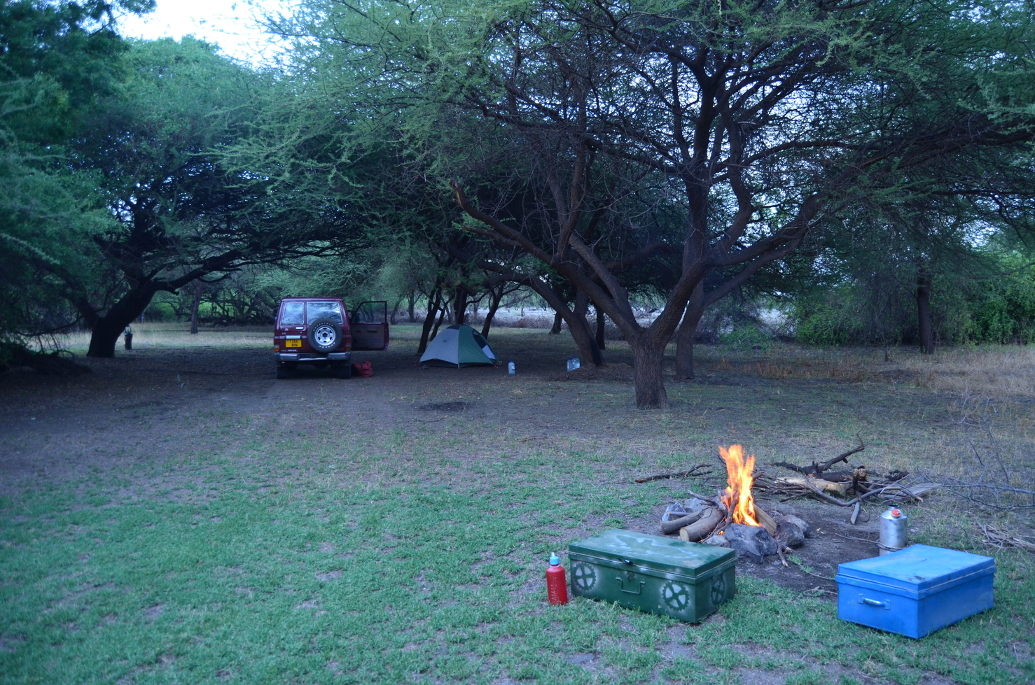
There is a very small village on the edge of Lake Natron called Engeresero with four or five accommodation options. We stayed at one that appeared to be an oasis with shady cover and basic camping facilities. They also had a small river fed pool, which was enjoyable not only for cooling off but also for watching birds come to take baths and drink.

Our campsite.

Relaxing at the pool.
The signs of safari tourism were certainly apparent in the town with every Masaai woman having a bag with bracelets that they attempted to sell. It was interesting being deep in Masaai land as the majority of people did not speak Swahili. It was like we were back at square one with the language barrier, which was frustrating since our Swahili is pretty decent these days. We were disappointed that the guy managing the camping area was a bit pushy and I felt he was trying to cheat us with the activity fees. He even wanted to charge us $20 for firewood! (I later bought some in town for $2). As a result we said that we'd explore the first day and if we couldn't find interesting spots on our own, we'd possibly come crawling back.

The road to the lake was very difficult to find and there was one other safari vehicle with tourists that we spotted. We took turns following each other and I thought he would lead us to the lake but later he stopped us and asked us what we were doing and where we were going and it was obvious we both had the same strategy and we both didn't want to let on that we didn't know where we were going. The road ends in a small village called Monica and the safari car stopped in the center attracting the attention of the locals. I tried to pretend the road continued but eventually we were on the outskirts of town and I decided to stop. There just so happened to be a shop keeper that spoke Swahili and we explained that we were looking for the lake. He tried to explain how to reach there but it was quite confusing and unclear so we agreed that he would join us and show us the way.

I was happy that he joined us because we would have never found the road by ourselves. He shared with us that he was from a village a few hours away and had moved a few months ago to start a small shop with his wife in Monica. He said he would like to join more tourists and alluded to poor management or a monopoly by certain people, likely those that spoke English. We spent the afternoon chatting and driving along the edge of the lake, stopping to take in the views, birds and flamingoes in the far distance. It's kind of unfortunate that the flamingoes like to breed in the middle of the lake, far from predators, as you can't see them very well without a telescope, though the vast numbers are still unimaginably impressive.

We even found our way to the "hot springs" which I was told was an additional $30 to visit. They weren't a traditional bathing hot springs but rather an extremely shallow area with some pools of hot water. We were told the road continued along for a few hours till you reached Kenya, perhaps a trip for another time.

We returned to our campsite and enjoyed a nice evening. It rained that evening so the temperatures remained cool and the soft lighting added another mystical dynamic to the landscape. The next day we met up with our new friend again and went to a waterfall, after which we took a walk through some acacia scrub land to try to find the lake (we were unsuccessful).

Lake Natron isn't on every tourists (or locals) radar because of it's isolated location and lack of big game wildlife. Still, the views are unique and beautiful and the area gives off an aura that is worth the trip!
Lake Natron with Ol Donyo Gelai (2,941m/9,650 ft) in the background.

Another view of Lake Natron with Ol Donyo Gelai (2,941m/9,650 ft) in the background.

Ol Donyo Longai to the south.

Freshwater coming out to meet the lake.

Lunch spot.

The hot springs.

Puttering around the hot springs.

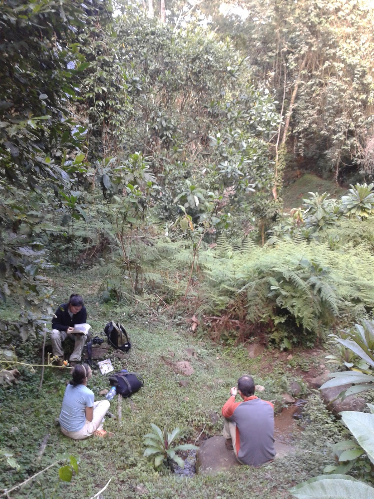
Checking out some birds.

View of the road.


The small village of Monica.

After the rains a rainbow stretched over Ol Donyo Gelai (2,941m/9,650 ft)

Sunday, November 8, 2015

Northern Mt. Kilimanjaro: Rongai III

A rare view of Mt. Kilimanjaro from the north side, at elevation. Mawenzi peak, to the left, is 5,149 metres (16,893 ft) while the highest peak on the right is 5,895 m (19,341 ft).
We've taken a few trips to Rongai (Trip I, Trip II) and although there isn't much to see in the area, the simple and adequate Snowcap Lodge and the significant change of altitude make for a nice mountain getaway.

We had never been to Rongai at this time of the year and we were surprised to find that the river was dry. We asked a local and they estimated that from September to December it was dry. Our main walk is focused on the thin strip of forest on the sides of the river and although it was quieter this time of year, it was still lush and green.

I really enjoyed the hotel ground this time around. The well landscaped area is a haven for sunbirds and provides a pleasant environment compared to the surrounding pine plantations. It is also a seemingly popular destination for weddings as the last two visits we've seen wedding processions take place here. It's interesting because it only seems to be a stopover for pictures, a procession (complete with a band and dancing) and then everyone gets back on the road and are gone as quickly as they arrived. Wedding parties come in at 4pm and are gone by 6pm and the crowd is naturally jubilant with many waves and smiles.

We were particularly happy this time around because we got the hot water working in the shower. Normally we don't have hot water showers but at this altitude (2,000m/6,500 ft) it is a must if you want to shower in the evening. They also have a fire in an over-sized fireplace in the lobby which would be an even better place to read and relax if not for the loud TV they also have in the room (which Tanzanians seem to be most interested in).

The only drawback to the trip is the elevation really takes it out of me. By the evening time I am so exhausted from walking that I can barely keep my eyes open. However, the combination of the cold, a bed stocked with blankets, the quiet surroundings, and the altitude, does make for some of my best nights sleep in Tanzania!
View of Snowcap Lodge.

The main rooms.

Inside the pine plantation.

Inside a sliver of natural forest.

In the nearly dry river with some pools remaining.

View of the plains to the east.

Friday, November 6, 2015

Lake Duluti: Trip III

Awesome picnic area.
Lake Duluti is one of my favorite day trips (Trip I, Trip II) because it's relatively close to Moshi (1 1/2 hours) and it provides a great place to go on a hike. You can walk along the crater rim or on a circuit around the lake through a very wooded area. There are hardly any other people there and the forest in the isolated rim of the crater gives a sense of true nature, though the audible music from the bar/restaurant can be an unfortunate reminder of how close you are to developed areas.

I also love this place because the park fees are extremely reasonable for residents. If I lived in Arusha (about a 20 minute drive) I'd be here every weekend for sure. The stunning views of Mt. Meru on a clear day and the vibrant bird life all offer a unique environment for the more arid and dry landscape (excluding Mt. Meru and Mt. Kilimanjaro).

We find ourselves doing the same route, mainly due to strategic choices in birding and temperature. We start the day climbing the ridge, come down for lunch, and then hike the forest path. We arrived at 9:30 and didn't leave until 4:00 and we really could have used more time. The place isn't large but there is ample space to explore!

View of Mt. Meru from the ridge.

View of Mt. Meru from the south side of the lake.

Great forest; notice the strangler fig slowly taking over the tree!