Monday, June 26, 2017

Kitulo National Park

Clouds coming in
This weekend we finally had the chance to visit Kitulo National Park, the first national park in sub-Saharan Africa to be gazetted primarily for its flora. Recently gazetted in 2005, the park is somewhat similar to Saadani National Park in that there are a few villages scattered throughout and the impact of humans is still visible across most of the landscape. However, it's a very unique area and even though we didn't visit during the flowering time, we still felt the park was well worth the visit for its unique montane grasslands and views from the plateau.

Kitulo National Park is located at 2,600 meters (8,500 ft) on a plateau and the majority of the park is montane grasslands. There are stunning views of forested mountains and valleys on the south side of the park as well. From the main highway we drove up a very steep road to the nearby village of Matamba. The temperature was extremely chilly and the area was largely dominated by agriculture with a variety of crops from maize to wheat. We found a comfortable guesthouse to spend the night and the next day drove about 20 minutes up even higher to the park gate.

Driving into the park provided a stunning view of the plateau and grasslands. We initially drove through the grasslands to the southern edge of the park and did some light hiking overlooking the mountains and villages below. The views were incredible and the clouds passed right in front of us. We then drove through the grasslands stopping at various points to check out the montane flora as well as the vistas. There was a small waterfall that we stopped at on the way to larger waterfall, though unfortunately we never made it to the larger waterfall due to the road being blocked and running out of time.

Kitulo National Park is known for its hiking and although we did some short hikes, we'd like to return during the flowering season to do a longer hike. It was unfortunate that the eastern part of the park is cut in half by an area that is quite developed with large cattle farms and expansive agriculture. There are also a steady stream of motorcycles and buses that go through the main park roads which can dampen the feeling of isolation and wilderness. There is only one other drivable road in the park that is not on the main roads and it's in quite poor condition.


Overall we quite enjoyed the park and hope to come back for a longer hike. The rains will certainly make the roads much more challenging. Getting to the village was difficult enough in the dry season and the roads in the park were also in very poor condition. It's unfortunate the park is so isolated as it requires a concentrated effort to get there and I wouldn't be surprised if people were disappointed since the wildlife is so sparse. We only saw two Mountain Reedbuck and although we saw some unique birds, there was also very sparse birdlife. However, if one is interested to take in the scenery and especially the flowers (in the rainy season), then the park does not disappoint!  
Grasslands in the morning
Looking south over the mountains

More clouds moving in 
Crossing a bridge over the grasslands 
Ana checking out the landscape
A cool little waterfall

More grasslands


Sunday, June 18, 2017

Ruaha National Park: Trips I & II

The Great Ruaha River
This month we were lucky enough to take two trips to Ruaha National Park, the nearest national park from where we live. It's only about a 40 minute drive to the gate from where we live and we'll likely take many trips to the park for both work and pleasure. Ruaha National Park is the largest national park in East Africa at 20,226 square kilometers (7,809 sq mi). The park is known for its expansive space and varied habitats such as rolling hills, large open plains, groves of baobabs, and along its southern border, the Great Ruaha River, from which the park gets its name. Most tourists come in the dry season when wildlife is abundant along the river.

Our first trip to the park was with two of our friends that live in nearby Iringa. They've visited the park several times but said that most trips were with different groups of people so they ended up doing the tried and true "river circuit". They wanted to see a different area of the park and we agreed we would circumvent a big hill and then make our way to the river. We then camped overnight at the public campsite by the river.

The first visit was a great introduction to Ruaha. The park is quite different than the parks we were accustomed to in the north with a much "bigger" feeling landscape and significantly less animals. The animals were also much more skittish compared to the mostly habituated animals in the north. We loved the huge views of the rolling hills and the river and we understood why many people enjoyed the wild feel of the park. When we camped at night we heard hippos making noise in the river all night, as well as lions nearby! It was unfortunately a full moon so sleeping was a bit difficult in the tent as it felt like someone had left a light on.

Our second trip was just ourselves and we tried driving to a supposed wetlands. Problem was, now is the dry season and the area was almost completely dry. There was barely any wildlife and the area was infested with tsetse flies. This meant that we had to roll our windows up (our car has no a/c) and within an hour we were desperate to leave that area of the park. I had actually taken my shirt off and we were both drenched with sweat as we finally reached a dry sandy river that was without tsetse flies. The rest of the afternoon we spent along the dry river and then passed by the river on our way out.

We saw some great wildlife that we don't see in the north, including Lesser and Greater Kudu. Elephants were quite abundant, as well as gazelles, giraffes, and some zebra. We didn't see any lions, leopards or cheetahs, though apparently they are quite difficult to find. Unlike the parks in the north where animals literally come up to your car, Ruaha requires more patience, which we look forward to practicing with each visit to the park!

Walking a bridge, a vestige of a time when no roads connected across the river and people had to transfer cars. 

Sand river
Classic acacia tree landscape 
A terrapin on the side of the road
Great Ruaha River

Friday, June 2, 2017

Road trip in Tanzania: Moshi to Kagera to Iringa

Map of our trip, starting in Moshi and ending in Iringa.
We lucked out with timing between our new jobs and ended up having two full weeks off. We had to drive all of our things crammed in (and on) our car from Moshi to Iringa, which would take about 15 hours or so if driving straight. We decided to try to break the trip up and initially we thought we would only have a week or so to work with. But as the time neared and we realized we'd have more like two weeks off, I began to get excited about the possibility of a road trip.

We've done several long drives and trips while here in Tanzania but the idea of having everything we own in our car for two weeks and being able to explore any part of the country seemed like the kind of adventure that would be a unique experience. With three and a half years in the country we felt equipped with enough knowledge of the culture and language skills to take us anywhere. We both love rural and seldom visited places and recognize the massive size of Tanzania.

However, a road trip in Tanzania is far different than a road trip in the USA or Europe. First of all, the GPS doesn't work and your smart phone won't be able to tell you where the nearest gas station is. In fact, you're more likely to have GoogleMaps mislabel a location and compound your sense of confusion. Second, the road conditions, though improving, are still overall quite poor with large stretches of unpaved, heavily potholed, or lurking with corrupt police looking to shake you down. Third, there isn't much formal tourism developed and information on seldom visited locations are either non-existent or sparse. We laughed wondering if it was more of a challenging/rewarding type of experience than it was an actual enjoyable experience. It's not necessarily comfortable but it is exciting and thought-provoking.

We had a general plan but agreed that the whole thing could change depending on how much we enjoyed somewhere, the weather, recommendations of others, our car breaking down, or anything else that might come our way. We decided to drive first to Singida and leave a big part of our luggage with friends there. This was critical because full of our possessions, our car was loaded to the brim and moved at a noticeably slower speed. From Moshi to Singida is 430km (270 miles), and we'd be able to drive 800km (500 miles) before coming back to Singida to pick up our load and finish the drive to Iringa, which was an additional 500km (333 miles).
Car loaded. 
We decided to drive up to the northwestern most region of Tanzania, called Kagera Region. Then we'd drive down the side of Lake Victoria stopping at Rubondo Island National Park and the second largest city in Tanzania, Mwanza. From there we'd make our way back to Singida and then onwards to Iringa. We had a couple of places we wanted to visit like a forest reserve, the national park, a wetland, but we weren't sure on driving times and conditions of the road since the rainy season had just ended there. In the end we just had to go for it and agree to make adjustments depending on anything that might come up.

I was really struck by the size and diversity of landscapes in Tanzania. We started the trip in Moshi which is in the midst of the rainy season. Roads are muddy and the landscape is lush and green everywhere you look. We then drove up to central highlands of Tanzania and would spend the rest of our trip around 1,100m (3,600 ft). As we drove up through the hilly landscape we passed Mt. Hanag (3417m/11,200 ft) and the air got noticeably chillier. As we headed west the landscape dried up as the rainy season occurred months earlier. The acacias and baobabs were also replaced by a miombo forests and mixed woodland. And then as we moved north again, the landscape raised up and we drove along a high escarpment overlooking Lake Victoria surrounded by lush green trees and landscapes closer resembling the eastern forests of Uganda and the Congo than Tanzania. The rainy season had ended only weeks before and the regions many swamps and wetlands were full. Heading down the escarpment south to Mwanza the landscape again dried out with a weak rainy season having passed months ago. As we headed south from Mwanza the acacias and baobabs reappeared and the landscape looked more familiar. From Singida to Dodoma we passed through another unique and fascinating habitat, the Itigi-Sumbu thicket. Dense and short shrub like trees stretched across the flat landscape, an abrupt change from the miombo and acacia surrounding it. The final bit from Dodoma to Iringa saw us driving through a sparsely inhabited area with stunning views of the mountains to the east. The final climb up the plateau to Iringa was beautiful and the road was cut out through undisturbed miombo forest. The cool air hit us at the top and we knew we had finally arrived at our new home.

We had a healthy mix of successful excursions to beautiful spots balanced with days we pushed too much and either met dead ends or underwhelming locations. We stayed at disgusting guesthouses infested with ants to having beachside rooms with hippos grazing 5m (15 ft) away. Amazing freshly caught fish roasted to perfection to spoiled diarrhea inducing fish disguised in spices. It's cliche but certainly there were highs and there were lows for sure. We had moments where we wondered why we don't stick to the guide books or spend a week at the beach but then we'd have moments where that question was answered. Freedom and exploration opened us up to so many interesting people and places.

At a time in our lives when we're making a big transition, the trip was a thought provoking and reflective experience. We don't have a radio or air conditioning, so it was windows down and conversation to keep ourselves busy. We noted the changes in landscape, the variance in products sold by different villagers on the roadside, and speculated about the different lives of the people that we passed. We were both reading conservation books about Tanzania so our minds were particularly keyed in on human/wildlife conflict, land use in Tanzania, agriculture, and economic development. After living in Moshi for 3 1/2 years, it was fitting that we took a very Tanzanian trip to enter into our next chapter of life here.
Ferrying across a river. The motor on the boat had an issue and luckily I had a wrench set I could lend the operator or I'm not sure how he would have fixed the issue. 
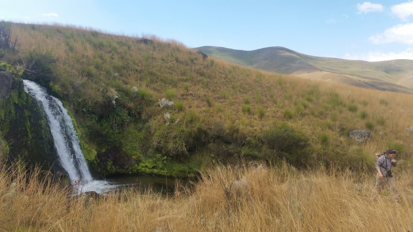
Up in the hills of Kagera. 

Leaving Rubondo Island National Park. 

A bigger ferry we boarded to cross the Mwanza gulf. 

Giving a lift to some kids that had to walk about 5km to get firewood for their school. We got five kids and their bundles onto our roof. 
Between Singida and Dodoma there was an oasis among the dry acacia habitat
View of the Rubeho Mountains coming from Dodoma to Iringa.

The view to the north climbing up to Iringa. 


Thursday, June 1, 2017

Mtera Resevoir

Ana scoping the shore
The final "stop" on our trip was a brief exploration of the Mtera Reservoir. It's the largest dam in Tanzania and straddles the Dodoma/Iringa Region borders. The lake is 56 kilometres (35 mi) long, and 15 kilometres (9.3 mi) wide and we decided to stop at the southernmost edge that we could find. We hoped that we could find a wetland or marshy area but instead came upon some fisherman and pastorlists grazing their animals.

It was a nice overcast day so the heat wasn't too bad. We went on a short walk around the edge of the lake and admired the size of the lake and the hills in the background. We thought it would make a good future camping expedition since it's about 2 hours from our new home. It's similar to the dam and reservoir that we used to visit, Nyumba ya Munga, though I doubt we'll get to visit as often.

Some views of the lake